 German
 English
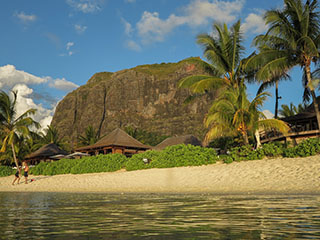
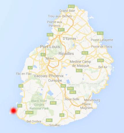
Le Morne Brabant
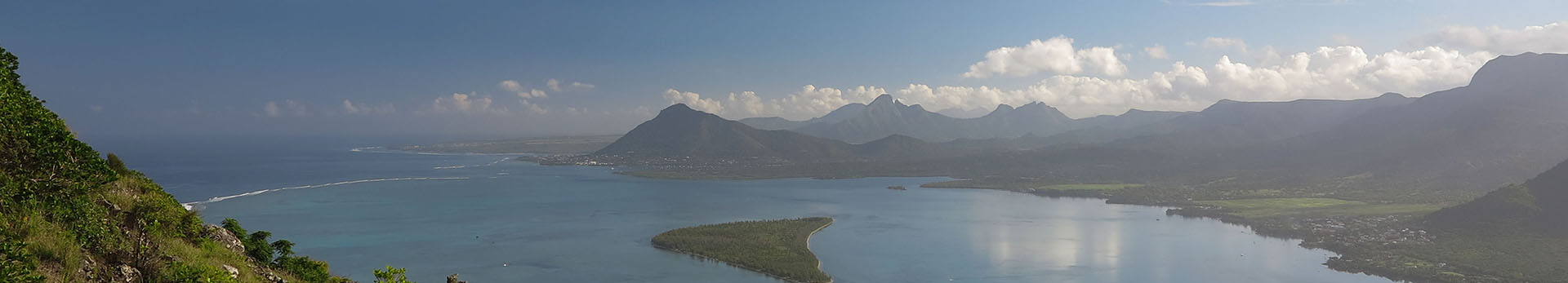
Since July 2016 this mountain is open to the public. The main trail goes straight to a viewpoint, but a lesser known trail circles the Le Morne Brabant in its entirety. And for those who want to climb the mountain from the west coast (Le Morne public beach) I will describe alternative entries.
| main entry - cross at the peak: | approx. 1 hour (ascent only) |
| 484m altitude difference |
Official entry
The official entry and the car park are located at the southern side of the Le Morne peninsula. There is a gate that opens at 7:00 in the morning and closes again in the afternoon at 16:00. There is also a guard sitting there who will explain you everything about the trail. Besides there is a guestbook where you have to sign you in when entering the area and after you are back you can sign out. But don't worry, nobody cares if you don't sign out and there won't be a search party. So you can take you time and enjoy the evening mood on the peak.
Alternative entries
If you are coming from the beaches on the western side of the Le Morne peninsula, e.g. from the public beach, you can save some time by not walking all the way to the main entry. There are two other entries to the site, which is otherwise fenced and surrounded by private properties. One of these entries is from the road in the northwest and another by a small trail near the riding stable "haras du morne". The entry that has been used by private tour operators and leads through a private property should no longer be used.
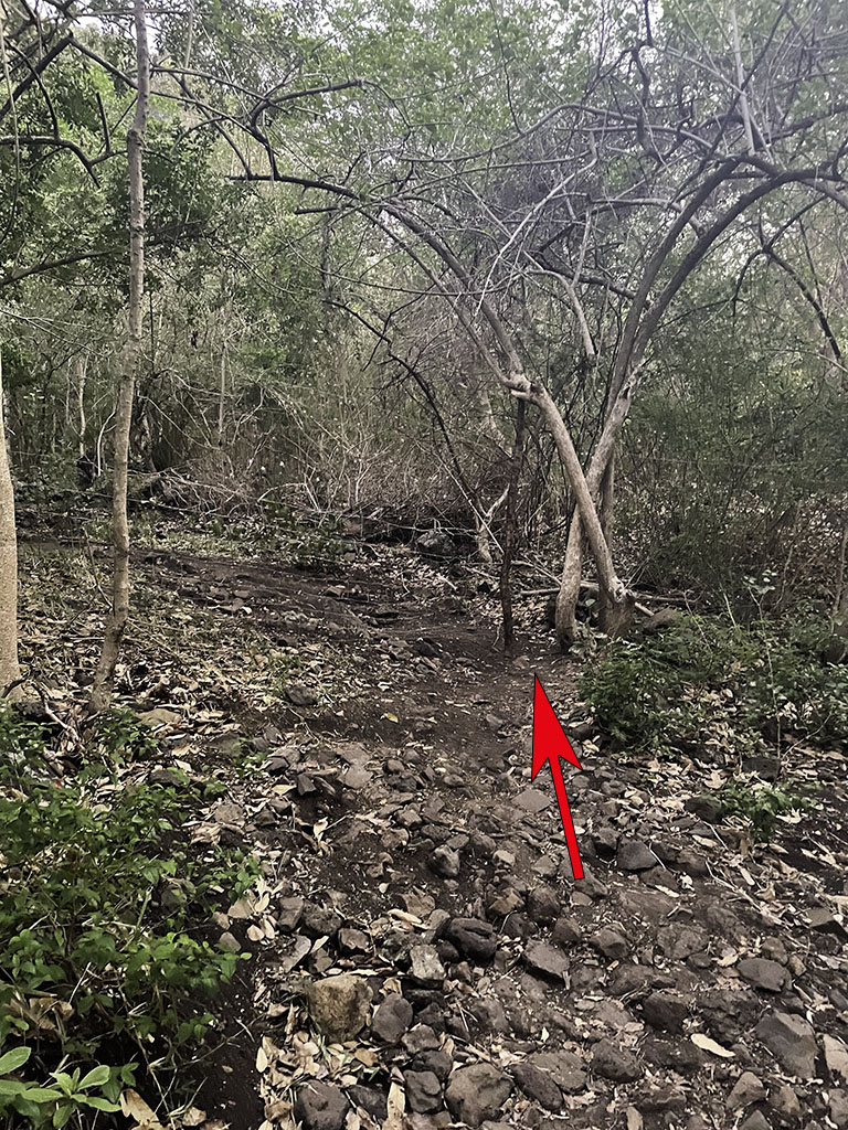
Right accross the main read from the Le Morne public beach an unpaved road leads to the riding stable "haras du morne". At the end of this road is a gate which is normaly closed, but can be bypassed by foot on the right side. Afterwards turn left, where the dirt road ends after a few meters. A few meters uphill there is a memorial stone for the Rastafarians:


Update Dezember 2022: A barely visible trail leads further uphill towards a fence and turns to the right. After a few meters there is an opening in the fence between two trees. If you continue the small trail behind the fence you will reach the wide official hiking trail to the viewpoint and the summit. We will continue on this trail to the left.
Trail characteristics
The first junction to the left is ignored, it will lead to a private property. At the 2nd junction you have the possibility to turn left and circle the Le Morne Brabant on a little travelled - and therefore quite overgrown - trail. Or you stay on the wide main trail and continue for about 40 minutes to the viewpoint.
Option 1: Right to the summit
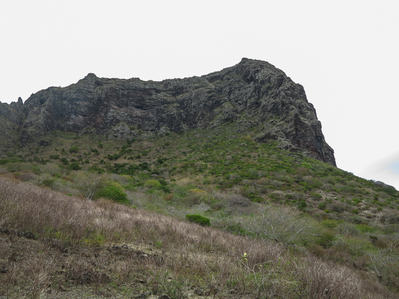
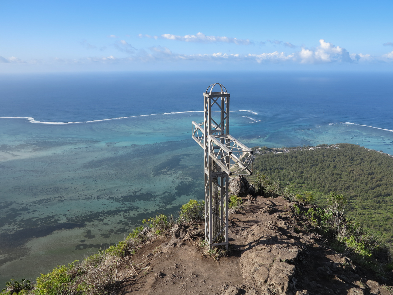
If you want to get to the summit as fast as possible just follow the main trail, which meanders along the hillside and quickly gains in altitude. After approx. 40 minutes you reach the viewpoint at the eastern side of the mountain. From here only a small trail continues to the summit, which quickly turns into a slight climbing and requires using your hands. After this upper part of the track has been temporarily closed in 2019, all ropes have been removed again because they were in bad condition. With a lot of oncoming traffic you have to take care for lose rocks that may fall down. After approx. 20 minutes the cross is reached. The real summit of the Le Morne Brabant cannot be reached without climbing equipment.
Option 2: Circle the Le Morne Brabant
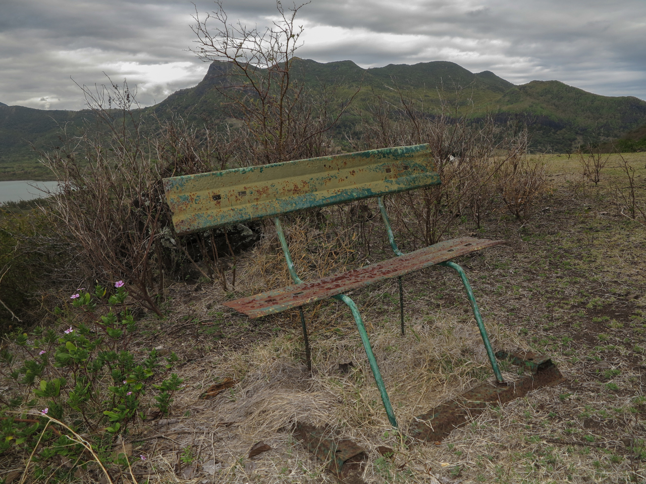
At the second junction mentioned earlier turn left. The trail follows an old driveway, which is pretty overgrown (at least it was in December 2016). Long trousers are beneficial as you will scratch your legs in the scrub otherwise. The trail continues more or less even along the foot of the Le Morne Brabant in north-western direction. With a bit of luck you may see deers in the slope to your right. To the left you will see the golf course of the Dinarobin hotel. Shortly before reaching a locked gate, turn right at a barely visible junction. If you would climb over the locked gate, you would reach a paved road that leads down to the main road. Our path instead is gaining on height and leads us along the fences of some expensive residences in eastern direction. Soon we reach an old rusty bench. Here again a path diverges to the right.
Those who already feel tired can continue straight ahead and circle the Le Morne Brabant on an elevation below the viewpoint. I did not try this trail but it should join the the main hiking trail sooner or later.
Instead we turn right and follow the old driveway uphill. After multiple turns we quickly gain on height. After passing another (open) gate we suddenly meet the main hiking trail near the viewpoint. From here we have the possibility to ascend to the summit in another approx. 20 minutes or continue the main trail back to the starting point of our hike.